La montagne des Ventes

1

A sporty itinerary with steep paths both up and down. But the ridge route allows you to recuperate and enjoy the scenery. It can also be done in the opposite direction.

Description

From Place des Tilleuls, take the GR9 to Grand Serre (430 m). Continue straight on, taking the tarmac road to the ACCA parking lot. At the Malemort crossroads (550 m) leave the GR9, climb left (stony track) to Col de Pousterle (851 m), follow the track for 700 m. At the pass, turn left to follow the ridge of the Montagne des Ventes. Descend to the left towards the Bourdeaux road. At the Gournier bridge (440 m), take the track on the left towards the ferme des Ventes (pass under the ruins). At 400 m, turn right onto the path. Descend and pass a tepee. Continue to the road and turn left before the bridge. Descend to the Poule ravine, skirt it and rejoin the GR9.
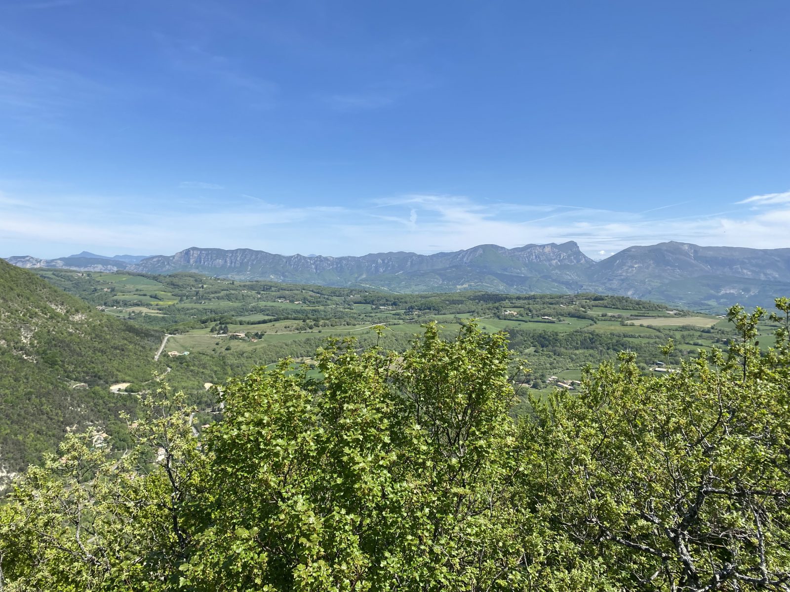
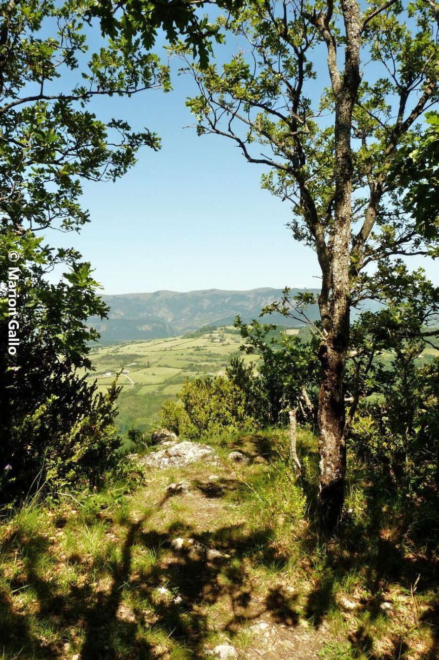
Beautiful panoramic view of the 3 Becs mountain and the Saoû forest.

History, culture and heritage

From mountains to valleys


The Montagne des Ventes is part of a large mountainous oval around Dieulefit. Clays, deposited at the bottom of the basin 80 million years ago, provide pottery clay. Cut by three rivers, this particular perched synclinal relief is closely reminiscent of the Saoû forest. To the north, between Les Ventes and Saoû, the primitive mountainous reliefs (anticlines) have disappeared: spectacular erosion has inverted the relief and carved out the present-day Rimandoule and Roubion valleys.

Guidebook with maps/step-by-step

1/ From Place des Tilleuls (alt. 380m) follow the white and red markers of the GR9 towards Grand Serre. Pass a bridge on the left and continue left to climb between houses.
Coordinates: (44.5270121, 5.0665306)
Distance from starting point: 4 m
2/ At Grand Serre (alt. 430m), continue straight ahead on the GR9. Follow the path to the tarmac road: turn right and climb until you leave the tarmac. Cross the Dieulefit ACCA parking lot.
Coordinates: (44.5294802, 5.0707719)
Distance from starting point: 8 km
3/ At the Malemort-Hautes Rouvières crossroads (alt. 550m), leave the GR9 to the right and follow the yellow markers to the left on the wide, stony track towards Col de la Pousterle. Follow the track for about 500m, then look out for a path on the right which climbs steeply to the Col de la Pousterle (alt. 851m).
Coordinates: (44.5300471, 5.0866537)
Distance from starting point: 2 km
4/ Go left along the crest of the Montagne des Ventes. Panoramic views of the Trois Becs and Saoû forest. Then descend to the left towards the road to Bourdeaux (beware of weak knees and ankles, the descent is steep).
Coordinates: (44.5418488, 5.0943484)
Distance from starting point: 4 km
5/ Arriving at the Pont de Gournier (alt. 440m), take the track on the left that climbs towards the ferme des Ventes (pass under the ruins). After about 400m, look out for the start of an undergrowth path on the right. Turn right onto a track, continue to the road and follow it downhill for 50m. Turn left before the small bridge and follow a track down to the Poule ravine. Follow it to find the white and red GR9 markers at Grand Serre. Return to Place des Tilleuls along the same path.
Coordinates: (44.5396154, 5.0749763)
Distance from starting point: 5 km

Labels and ranking

  • Open air

Activities

  • Pedestrian sports
  • Hiking itinerary

Visit

Individual tour

  • Average Duration of the individual tour: 210 minutes

Situation

Show itinerary

To see the spot on the map, you can fly over the altitude difference below.